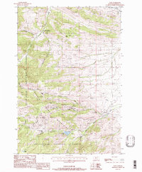
1988 Map of Pony
USGS Topo · Published 1988About this map
Mining operations and high mountain terrain dominate this corner of Madison County within the Tobacco Root Mountains. The settlement of Pony sits at the edge of the range, serving as a gateway to a landscape heavily worked by prospectors and mining companies. Dozens of mining features are documented, including the Boss Tweed Mine, Atlantic and Pacific Mine, and the Pony Mine, alongside numerous prospects and adits scattered across Strawberry Ridge and Charcoal Ridge.
Find a feature on this map
44 named features on this map. Tap any name to fly to it.
Don’t see what you’re looking for? This feature index may not catch every label — zoom into the map to look around manually.
Map Details
Editions of this 1988 Pony Map
This is the sole edition of this map. No revisions or reprints were ever made.
Other maps of this area

1888 · Three Forks
USGS Topo · 1:250,000

1893 · Dillon
USGS Topo · 1:250,000

1894 · Three Forks
USGS Topo · 1:250,000

1895 · Three Forks
USGS Topo · 1:250,000

1947 · Bozeman
USGS Topo · 1:250,000

1948 · Bozeman
USGS Topo · 1:250,000

1950 · Jefferson Island
USGS Topo · 1:62,500

1950 · Harrison
USGS Topo · 1:62,500

1955 · Bozeman
USGS Topo · 1:250,000

1955 · Dillon
USGS Topo · 1:250,000