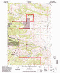
1996 Map of Pony
USGS Topo · Published 1998About this map
The high peaks of the Tobacco Root Mountains dominate this landscape, where mining history is etched into every canyon. The settlement of Pony sits at the base of the mountains, serving as a gateway to numerous hard-rock claims and prospects. Higher elevations are marked by the Strawberry Mine, Atlantic and Pacific Mine, and Garnet Gold Mine, illustrating the intense mineral exploration that defined this corner of Madison County. The presence of the Indiana University Geology Field Station along the Boulder River underscores the area's significance as a living laboratory for geological study.
Find a feature on this map
38 named features on this map. Tap any name to fly to it.
Don’t see what you’re looking for? This feature index may not catch every label — zoom into the map to look around manually.
Map Details
Editions of this 1996 Pony Map
This is the sole edition of this map. No revisions or reprints were ever made.
Other maps of this area

1888 · Three Forks
USGS Topo · 1:250,000

1893 · Dillon
USGS Topo · 1:250,000

1894 · Three Forks
USGS Topo · 1:250,000

1895 · Three Forks
USGS Topo · 1:250,000

1947 · Bozeman
USGS Topo · 1:250,000

1948 · Bozeman
USGS Topo · 1:250,000

1950 · Jefferson Island
USGS Topo · 1:62,500

1950 · Harrison
USGS Topo · 1:62,500

1955 · Bozeman
USGS Topo · 1:250,000

1955 · Dillon
USGS Topo · 1:250,000