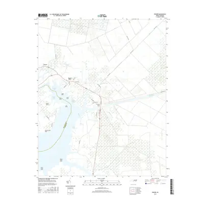
2016 Map of Ponzer
USGS Topo · Published 2016About this map
Ponzer and Mount Olive sit within a coastal landscape defined by the intricate shoreline of the Intracoastal Waterway and numerous tributary creeks. This environment is shaped by a dense network of drainage and transportation, where the Wilkerson Creek Bridge carries highway traffic over a complex system of marshes and sounds. The map illustrates the transition from inland agricultural tracts to the wetlands of Crabtree Bay and Sophie Island, revealing how the low-lying terrain of the Beaufort Co and Hyde Co border has historically influenced settlement patterns. From the Old State Canal in the northeast to the various points extending into the water like Satterthwaite Point and Broad Creek Point, the geography highlights the region's reliance on water-based infrastructure and coastal access. Local family names are reflected in the road network, such as Squires Rd and Wilbanks Rd, which connect these small communities to the surrounding wildlands.
Find a feature on this map
41 named features on this map. Tap any name to fly to it.
Don’t see what you’re looking for? This feature index may not catch every label — zoom into the map to look around manually.
Map Details
Editions of this 2016 Ponzer Map
This is the sole edition of this map. No revisions or reprints were ever made.
Other maps of this area

1914 · Belhaven
USGS Topo · 1:48,000

1916 · Belhaven
USGS Topo · 1:62,500

1943 · Columbia
USGS Topo · 1:125,000

1943 · Plymouth
USGS Topo · 1:125,000

1951 · Pamlico Beach
USGS Topo · 1:24,000

1951 · Belhaven
USGS Topo · 1:24,000

1951 · Scranton
USGS Topo · 1:24,000

1951 · Swanquarter
USGS Topo · 1:24,000

1951 · Ponzer
USGS Topo · 1:24,000

1951 · New Lake SE
USGS Topo · 1:24,000