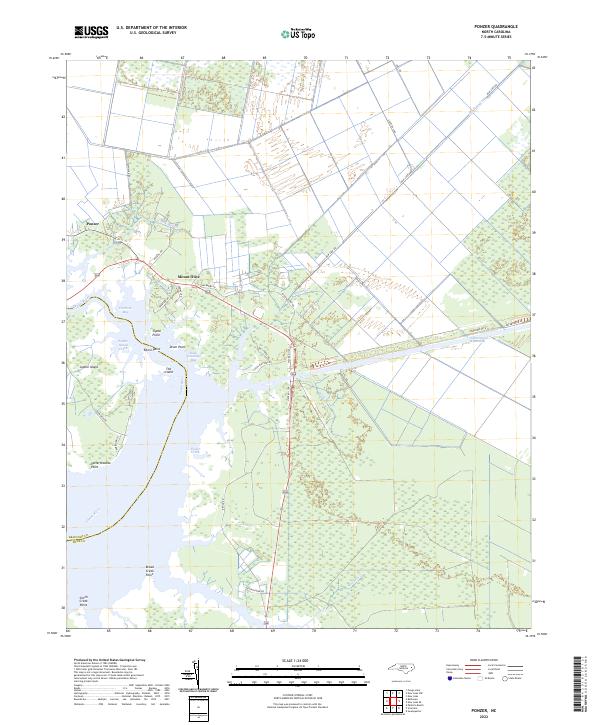
2022 Map of Ponzer
USGS Topo · Published 2022About this map
The Pungo River shoreline and its intricate network of bays and inlets dominate this coastal Hyde County landscape. The settlements of Ponzer and Mount Olive serve as focal points along the northern edge, where the agricultural grid meets the marshy expanse of The Island and Sophie Island. Navigation is a central theme of the geography, with the Intracoastal Waterway cutting a straight path through the eastern wetlands toward the Wilkerson Cr basin.
Find a feature on this map
41 named features on this map. Tap any name to fly to it.
Don’t see what you’re looking for? This feature index may not catch every label — zoom into the map to look around manually.
Map Details
Editions of this 2022 Ponzer Map
This is the sole edition of this map. No revisions or reprints were ever made.
Other maps of this area

1914 · Belhaven
USGS Topo · 1:48,000

1916 · Belhaven
USGS Topo · 1:62,500

1943 · Columbia
USGS Topo · 1:125,000

1943 · Plymouth
USGS Topo · 1:125,000

1951 · Pamlico Beach
USGS Topo · 1:24,000

1951 · Belhaven
USGS Topo · 1:24,000

1951 · Scranton
USGS Topo · 1:24,000

1951 · Swanquarter
USGS Topo · 1:24,000

1951 · Ponzer
USGS Topo · 1:24,000

1951 · New Lake SE
USGS Topo · 1:24,000