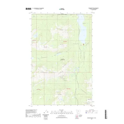
2020 Map of Porcupine Ridge
USGS Topo · Published 2020About this map
Glacier National Park defines the high-altitude landscape of this 2020 survey, where the international boundary between the United States and Canada follows the northern edge of the map. The geography is dominated by massive features like Porcupine Ridge and the Citadel Peaks, while the high-altitude hydrology is marked by Upper Waterton Lake and the Waterton River. The intersection of two major long-distance paths, the Continental Divide National Scenic Trail and the Pacific NW National Scenic Trail, highlights the importance of this region as a nexus for wilderness travel.
Find a feature on this map
38 named features on this map. Tap any name to fly to it.
Don’t see what you’re looking for? This feature index may not catch every label — zoom into the map to look around manually.
Map Details
Editions of this 2020 Porcupine Ridge Map
This is the sole edition of this map. No revisions or reprints were ever made.
Other maps of this area

1904 · Chief Mountain
USGS Topo · 1:125,000

1906 · Kintla Lakes
USGS Topo · 1:125,000

1938 · Chief Mountain
USGS Topo · 1:125,000

1938 · Kintla Lakes
USGS Topo · 1:125,000

1957 · Kalispell
USGS Topo · 1:250,000

1960 · Kalispell
USGS Topo · 1:250,000

1960 · Cut Bank
USGS Topo · 1:250,000

1961 · Kalispell
USGS Topo · 1:250,000

1963 · Cut Bank
USGS Topo · 1:250,000

1964 · Cut Bank
USGS Topo · 1:250,000