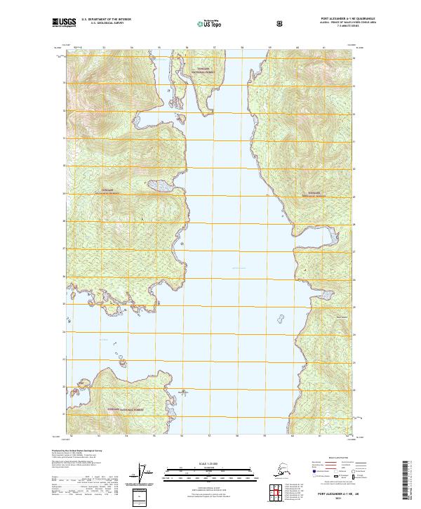
2021 Map of Port Alexander A-1 NE
USGS Topo · Published 2021About this map
Tongass National Forest dominates this coastal Alaska landscape, where the intricate shoreline of Kuiu Island meets the Pacific waters. The terrain is defined by deep marine inlets and narrow waterways, most notably the central expanse of Affleck Canal. This 2021 study illustrates a region where land and sea are inextricably linked, showing the complex archipelago geography typical of the Prince of Wales-Hyder Census Area. Smaller features like Bear Harbor in the north and Kell Bay to the west provide protected anchorages amidst the larger coastal indentations. The presence of the Bush Islets at the southern entrance of the canal highlights the navigational complexity of these waters, which remain largely undeveloped and managed as part of the national forest system.
Find a feature on this map
10 named features on this map. Tap any name to fly to it.
Don’t see what you’re looking for? This feature index may not catch every label — zoom into the map to look around manually.
Map Details
Editions of this 2021 Port Alexander A-1 NE Map
This is the sole edition of this map. No revisions or reprints were ever made.
Other maps of this area

1948 · Petersburg A-6
USGS Topo · 1:63,360

1948 · Port Alexander A-1
USGS Topo · 1:63,360

1948 · Petersburg B-6
USGS Topo · 1:63,360

1948 · Port Alexander B-1
USGS Topo · 1:63,360

1951 · Port Alexander
USGS Topo · 1:250,000

1951 · Petersburg B-6
USGS Topo · 1:63,360

1951 · Petersburg A-6
USGS Topo · 1:63,360

1952 · Petersburg
USGS Topo · 1:250,000

1952 · Port Alexander
USGS Topo · 1:250,000
1953 · Port Alexander B-1
USGS Topo · 1:63,360