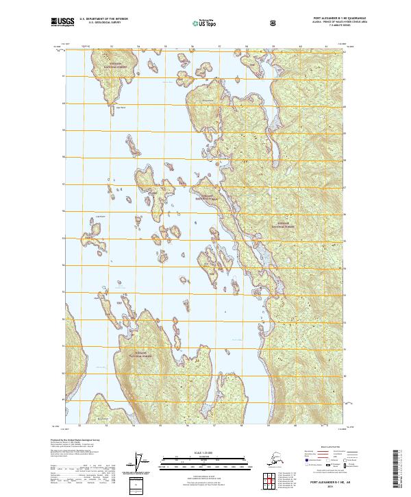
2021 Map of Port Alexander B-1 NE
USGS Topo · Published 2021About this map
Kuiu Island dominates this portion of the Tongass National Forest, characterized by a complex network of coastal inlets and protected waters. The landscape is defined by its maritime geography, where large bodies of water like Elena Bay and Petrof Bay cut deep into the timbered interior. Coastal navigation points such as Gap Point, Elena Point, and Lisa Point denote the intricate shoreline of the Alexander Archipelago. Small, sheltered locations like Orel Anchorage and Happy Cove suggest the area's importance for maritime refuge and small-craft passage. The distribution of features like East Island, Step Island, and the precarious Oyster Rock highlights a terrain where land and sea are constantly intertwined, supporting a wilderness environment managed for its natural resources and ecological value.
Find a feature on this map
20 named features on this map. Tap any name to fly to it.
Don’t see what you’re looking for? This feature index may not catch every label — zoom into the map to look around manually.
Map Details
Editions of this 2021 Port Alexander B-1 NE Map
This is the sole edition of this map. No revisions or reprints were ever made.
Other maps of this area

1948 · Port Alexander C-1
USGS Topo · 1:63,360

1948 · Petersburg B-6
USGS Topo · 1:63,360

1948 · Port Alexander B-1
USGS Topo · 1:63,360

1948 · Petersburg C-6
USGS Topo · 1:63,360

1951 · Port Alexander
USGS Topo · 1:250,000

1951 · Port Alexander C-1
USGS Topo · 1:63,360

1951 · Petersburg B-6
USGS Topo · 1:63,360

1952 · Petersburg
USGS Topo · 1:250,000

1952 · Port Alexander
USGS Topo · 1:250,000
1953 · Port Alexander B-1
USGS Topo · 1:63,360