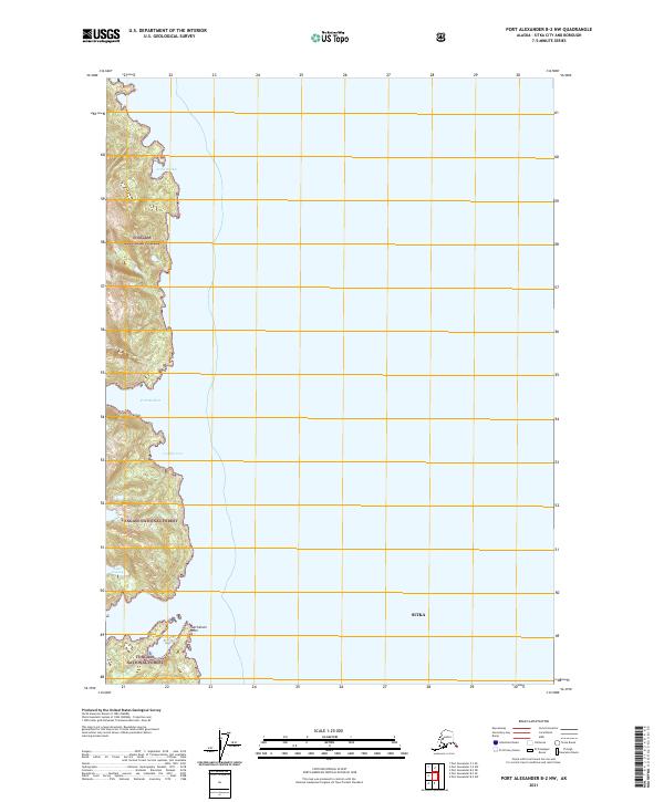
2021 Map of Port Alexander B-2 NW
USGS Topo · Published 2021About this map
Tongass National Forest covers the coastal elevations of Baranof Island in this detailed topographical study within the Sitka city and borough. The map documents the intricate coastline of the Alexander Archipelago, defined by deep-water inlets including Port Herbert and the sheltered waters of Jerry Harbor. The presence of Lake Osprey and Sashin Cr indicates the freshwater drainage systems that characterize this part of Southeast Alaska. This map is a record of the wilderness boundary lines as they stood in 2021, particularly the public land survey system markers for t62s r69e and t63s r69e. The landscape is dominated by steep coastal terrain that drops sharply into Codfish Cove and terminates at the prominent Hutchinson Point, illustrating the maritime geography of the region.
Find a feature on this map
10 named features on this map. Tap any name to fly to it.
Don’t see what you’re looking for? This feature index may not catch every label — zoom into the map to look around manually.
Map Details
Editions of this 2021 Port Alexander B-2 NW Map
This is the sole edition of this map. No revisions or reprints were ever made.
Other maps of this area

1948 · Port Alexander B-2
USGS Topo · 1:63,360

1951 · Port Alexander C-2
USGS Topo · 1:63,360

1951 · Port Alexander B-3 and B-4
USGS Topo · 1:63,360

1951 · Port Alexander C-3
USGS Topo · 1:63,360

1951 · Port Alexander
USGS Topo · 1:250,000

1951 · Port Alexander B-2
USGS Topo · 1:63,360

1952 · Port Alexander
USGS Topo · 1:250,000

1964 · Port Alexander
USGS Topo · 1:250,000

1994 · Port Alexander C-3
USGS Topo · 1:63,360
2017 · Port Alexander C-2 SW
USGS Topo · 1:25,000