
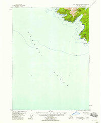
1948 Map of Port Alexander B-2
USGS Topo · Published 1958About this map
Baranof Island meets the deep waters of Chatham Strait in this coastal survey, where maritime activity is concentrated in numerous sheltered inlets and coves. The settlement of Port Alexander serves as a southern anchor, located near the intersection of Ship Cove and Graveyard Cove. Further north along the coast, Port Armstrong and the isolated Cabin at New Port Walter reflect the sparse but intentional development of the area's timber and fishing resources.
Find a feature on this map
29 named features on this map. Tap any name to fly to it.
Don’t see what you’re looking for? This feature index may not catch every label — zoom into the map to look around manually.
Map Details
Editions of this 1948 Port Alexander B-2 Map
This is the sole edition of this map. No revisions or reprints were ever made.
Other maps of this area

1948 · Port Alexander C-1
USGS Topo · 1:63,360

1948 · Port Alexander A-1
USGS Topo · 1:63,360

1948 · Port Alexander B-1
USGS Topo · 1:63,360

1948 · Port Alexander A-2
USGS Topo · 1:63,360
1948 · Port Alexander A-3
USGS Topo · 1:63,360

1951 · Port Alexander C-2
USGS Topo · 1:63,360

1951 · Port Alexander B-3 and B-4
USGS Topo · 1:63,360

1951 · Port Alexander C-3
USGS Topo · 1:63,360

1951 · Port Alexander
USGS Topo · 1:250,000

1951 · Port Alexander B-2
USGS Topo · 1:63,360