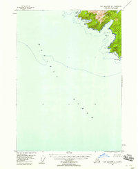
1948 Map of Port Alexander A-3
USGS Topo · Published 1958About this map
Baranof Island meets the Pacific Ocean at the southern tip of the Alexander Archipelago in this 1948 survey. The landscape is defined by its dramatic coastline, where steep terrain like Ommaney Peak rises sharply from the water's edge. The jagged shoreline is broken by several deep-water inlets, including Larch Bay, Puffin Bay, and Little Puffin Bay, providing natural shelter in an otherwise exposed maritime environment.
Find a feature on this map
13 named features on this map. Tap any name to fly to it.
Don’t see what you’re looking for? This feature index may not catch every label — zoom into the map to look around manually.
Map Details
Editions of this 1948 Port Alexander A-3 Map
This is the sole edition of this map. No revisions or reprints were ever made.
Other maps of this area

1948 · Port Alexander A-2
USGS Topo · 1:63,360

1948 · Port Alexander B-2
USGS Topo · 1:63,360

1951 · Port Alexander B-3 and B-4
USGS Topo · 1:63,360

1951 · Port Alexander
USGS Topo · 1:250,000

1951 · Port Alexander B-2
USGS Topo · 1:63,360
1951 · Port Alexander A-3
USGS Topo · 1:63,360
1951 · Port Alexander A-2
USGS Topo · 1:63,360

1952 · Port Alexander
USGS Topo · 1:250,000

1957 · Craig
USGS Topo · 1:250,000

1964 · Port Alexander
USGS Topo · 1:250,000