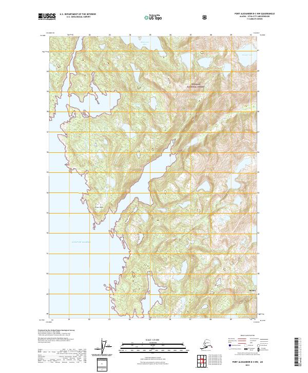
2021 Map of Port Alexander B-3 NW
USGS Topo · Published 2021About this map
Tongass National Forest dominates the terrain of this coastal Alaskan landscape, where the dense coastal woodland meets the open waters of the Gulf of Alaska. The map reveals a highly irregular shoreline defined by deep inlets and prominent points such as Snipe Head. This 2021 update preserves the remote character of the Sitka borough, showing a wilderness largely devoid of modern road infrastructure but punctuated by significant freshwater bodies like Maksoutof Lake and Antipatr Lake. The contour lines illustrate the steep, rising elevations typical of the Alexander Archipelago, providing a clear record of the glacial topography and water drainage patterns within this protected forest region.
Find a feature on this map
9 named features on this map. Tap any name to fly to it.
Don’t see what you’re looking for? This feature index may not catch every label — zoom into the map to look around manually.
Map Details
Editions of this 2021 Port Alexander B-3 NW Map
This is the sole edition of this map. No revisions or reprints were ever made.
Other maps of this area

1951 · Port Alexander C-4
USGS Topo · 1:63,360

1951 · Port Alexander B-3 and B-4
USGS Topo · 1:63,360

1951 · Port Alexander C-3
USGS Topo · 1:63,360

1951 · Port Alexander
USGS Topo · 1:250,000

1952 · Port Alexander
USGS Topo · 1:250,000

1964 · Port Alexander
USGS Topo · 1:250,000

1994 · Port Alexander C-3
USGS Topo · 1:63,360

1994 · Port Alexander C-4
USGS Topo · 1:63,360
2017 · Port Alexander B-4 NE
USGS Topo · 1:25,000
2017 · Port Alexander C-4 SE
USGS Topo · 1:25,000