
1951 Map of Port Alexander C-4
USGS Topo · Published 1958About this map
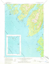
Baranof Island dominates this 1951 study of the Alaskan coast, revealing a landscape defined by deep fjords and isolated harbors within the Tongass National Forest. The complex waterway of Crawfish Inlet and the Middle Channel frame numerous landforms like Beauchamp Island and the Yamani Islets. The charting reflects mid-century maritime needs, identifying safe anchorages such as Toy Harbor and Still Harbor along the jagged southwestern shore. This area, largely untouched by infrastructure, shows no roads or trails, emphasizing the reliance on water transport for navigating the coastal inlets. Notable navigational landmarks such as Biali Rock and the Guibert Islets appear in the Pacific Ocean and Necker Bay, marking the boundary between the open sea and the sheltered passages of the Alaskan panhandle.
Find a feature on this map
36 named features on this map. Tap any name to fly to it.
Don’t see what you’re looking for? This feature index may not catch every label — zoom into the map to look around manually.
Map Details
Editions of this 1951 Port Alexander C-4 Map
2 editions found
Other maps of this area

1951 · Port Alexander D-5
USGS Topo · 1:63,360

1951 · Port Alexander D-4
USGS Topo · 1:63,360

1951 · Port Alexander B-3 and B-4
USGS Topo · 1:63,360

1951 · Port Alexander C-3
USGS Topo · 1:63,360

1951 · Port Alexander D-3
USGS Topo · 1:63,360

1951 · Port Alexander
USGS Topo · 1:250,000

1952 · Port Alexander
USGS Topo · 1:250,000

1964 · Port Alexander
USGS Topo · 1:250,000

1994 · Port Alexander C-3
USGS Topo · 1:63,360

1994 · Port Alexander C-4
USGS Topo · 1:63,360