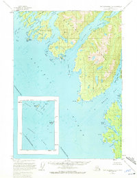
1951 Map of Port Alexander C-4
USGS Topo · Published 1972About this map
Baranof Island and its intricate shoreline dominate this coastal study, revealing a complex network of waterways south of the main Sitka settlements. The map illustrates the deep penetration of Crawfish Inlet and Necker Bay into the island's interior, providing a record of the maritime geography as it was documented in the mid-20th century. Maritime landmarks like Middle Channel, Still Harbor, and Yamani Cove highlight the protected anchorages and passages used by fishing fleets and local travelers before modern navigational aids were standard. The dense clustering of the Rakof Islands and the Necker Islands offshore speaks to the navigational challenges of the Alaskan Panhandle. Notable land features like Beauchamp Island and Lodge Island sit amidst these channels, anchoring a landscape where the sea and land are inextricably linked.
Find a feature on this map
35 named features on this map. Tap any name to fly to it.
Don’t see what you’re looking for? This feature index may not catch every label — zoom into the map to look around manually.
Map Details
Editions of this 1951 Port Alexander C-4 Map
2 editions found
Other maps of this area

1951 · Port Alexander D-5
USGS Topo · 1:63,360

1951 · Port Alexander C-4
USGS Topo · 1:63,360

1951 · Port Alexander D-4
USGS Topo · 1:63,360

1951 · Port Alexander B-3 and B-4
USGS Topo · 1:63,360

1951 · Port Alexander C-3
USGS Topo · 1:63,360

1951 · Port Alexander D-3
USGS Topo · 1:63,360

1951 · Port Alexander
USGS Topo · 1:250,000

1952 · Port Alexander
USGS Topo · 1:250,000

1964 · Port Alexander
USGS Topo · 1:250,000

1994 · Port Alexander C-3
USGS Topo · 1:63,360