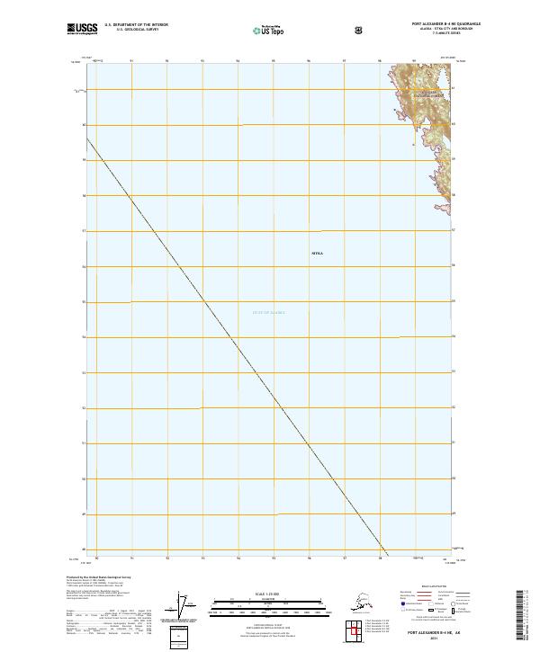
2021 Map of Port Alexander B-4 NE
USGS Topo · Published 2021About this map
Tongass National Forest dominates the upper right corner of this coastal sheet, where the mountainous terrain of the Alexander Archipelago meets the open sea. While the vast majority of this 2021 survey covers the deep waters of the Gulf of Alaska, the eastern edge provides a detailed topographic record of the island coastline within the Sitka city and borough. The map illustrates the sharp transition from steep, forested slopes to the sea, reflecting the rugged character of this maritime region. Geodetic lines for t62s r66e, t62s r67e, and t63s r67e establish the Public Land Survey System grid across the expanse, providing a precise framework for marine and wilderness navigation in Southeast Alaska.
Find a feature on this map
6 named features on this map. Tap any name to fly to it.
Don’t see what you’re looking for? This feature index may not catch every label — zoom into the map to look around manually.
Map Details
Editions of this 2021 Port Alexander B-4 NE Map
This is the sole edition of this map. No revisions or reprints were ever made.
Other maps of this area

1951 · Port Alexander C-4
USGS Topo · 1:63,360

1951 · Port Alexander B-3 and B-4
USGS Topo · 1:63,360

1951 · Port Alexander C-3
USGS Topo · 1:63,360

1951 · Port Alexander
USGS Topo · 1:250,000

1952 · Port Alexander
USGS Topo · 1:250,000

1964 · Port Alexander
USGS Topo · 1:250,000

1994 · Port Alexander C-3
USGS Topo · 1:63,360

1994 · Port Alexander C-4
USGS Topo · 1:63,360
2017 · Port Alexander B-4 NE
USGS Topo · 1:25,000
2017 · Port Alexander C-4 SE
USGS Topo · 1:25,000