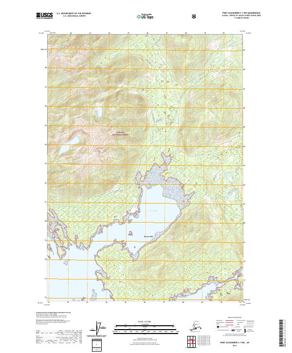
2021 Map of Port Alexander C-1 NW
USGS Topo · Published 2021About this map
Tongass National Forest dominates the terrain of this coastal quadrangle, where the deep waters of Rowan Bay and Upper Rowan Bay cut into the densely timbered landscape. The area shows evidence of human activity and resource management with the presence of Behind Camp situated along the northern shore of the bay. Navigation and movement through this wilderness are marked by the Kuiu Connection, a route that links the bay area to the interior of the island. The coastal profile is defined by intricate inlets and named points such as Upper Pillar Bay and the evocative Lost Men along the eastern shoreline. This 2021 update preserves the contemporary status of these forest lands and maritime features, illustrating the isolation and specialized land use typical of the Alaska Panhandle's southern reaches.
Find a feature on this map
14 named features on this map. Tap any name to fly to it.
Don’t see what you’re looking for? This feature index may not catch every label — zoom into the map to look around manually.
Map Details
Editions of this 2021 Port Alexander C-1 NW Map
This is the sole edition of this map. No revisions or reprints were ever made.
Other maps of this area

1948 · Port Alexander C-1
USGS Topo · 1:63,360

1948 · Port Alexander D-1
USGS Topo · 1:63,360

1951 · Port Alexander C-2
USGS Topo · 1:63,360

1951 · Port Alexander
USGS Topo · 1:250,000

1951 · Port Alexander D-2
USGS Topo · 1:63,360

1951 · Port Alexander C-1
USGS Topo · 1:63,360

1952 · Port Alexander
USGS Topo · 1:250,000

1964 · Port Alexander
USGS Topo · 1:250,000
1995 · Port Alexander D-2
USGS Topo · 1:63,360
1997 · Port Alexander C-1
USGS Topo · 1:63,360