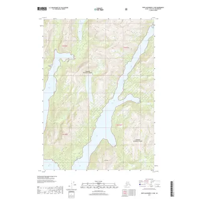
2017 Map of Port Alexander C-3 NW
USGS Topo · Published 2017About this map
Tongass National Forest encloses the steep, glaciated topography of this region on Baranof Island, where the sea deeply penetrates the coastal mountains. The landscape is defined by the dramatic bifurcations of Whale Bay, which splits into the massive corridors of the Great Arm and the Small Arm. These narrow waterways are flanked by precipitous slopes rising directly from the shoreline to peaks like Mt Emma, creating a complex network of fjords characteristic of the Alexander Archipelago. Inland, isolated basins hold bodies of water such as Avoss Lake and Politofski Lake, which are disconnected from the primary saltwater inlets by narrow ridges and high-elevation terrain. The map captures a wilderness environment where the lack of roads or established settlements emphasizes the reliance on maritime and aerial access for navigation through the dense forest and over the jagged peaks.
Find a feature on this map
11 named features on this map. Tap any name to fly to it.
Don’t see what you’re looking for? This feature index may not catch every label — zoom into the map to look around manually.
Map Details
Editions of this 2017 Port Alexander C-3 NW Map
This is the sole edition of this map. No revisions or reprints were ever made.
Other maps of this area

1951 · Port Alexander C-4
USGS Topo · 1:63,360

1951 · Port Alexander D-4
USGS Topo · 1:63,360

1951 · Port Alexander C-3
USGS Topo · 1:63,360

1951 · Port Alexander D-3
USGS Topo · 1:63,360

1951 · Port Alexander
USGS Topo · 1:250,000

1952 · Port Alexander
USGS Topo · 1:250,000

1964 · Port Alexander
USGS Topo · 1:250,000

1994 · Port Alexander C-3
USGS Topo · 1:63,360

1994 · Port Alexander C-4
USGS Topo · 1:63,360
1995 · Port Alexander D-3
USGS Topo · 1:63,360