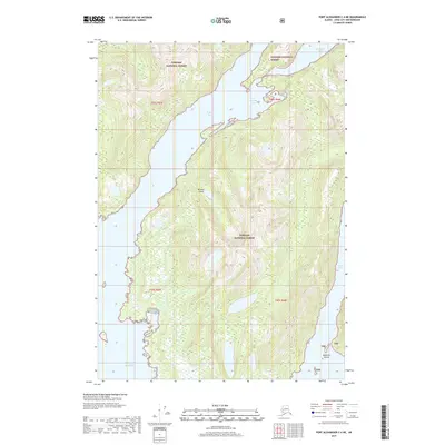
2017 Map of Port Alexander C-4 NE
USGS Topo · Published 2017About this map
Baranof Island dominates this portion of the Alexander Archipelago, showing a landscape defined by deep fjords and maritime isolation within the Tongass National Forest. The complex shoreline is articulated by several protected inlets including Necker Bay and the narrow waters of Small Arm. To the north, Secluded Bay and Dorothy Cove offer shelter from the open waters of the Gulf of Alaska that edge the southern reaches of the map. This 2017 survey reflects the enduring wilderness character of the region, where topographical detail reveals the sharp rise of the land from sea level. The inclusion of smaller features like Toy Harbor and the Makhnati Islands highlights the intricate coastal geography that has long dictated navigation and subsistence in this part of Alaska.
Find a feature on this map
14 named features on this map. Tap any name to fly to it.
Don’t see what you’re looking for? This feature index may not catch every label — zoom into the map to look around manually.
Map Details
Editions of this 2017 Port Alexander C-4 NE Map
This is the sole edition of this map. No revisions or reprints were ever made.
Other maps of this area

1951 · Port Alexander C-4
USGS Topo · 1:63,360

1951 · Port Alexander D-4
USGS Topo · 1:63,360

1951 · Port Alexander C-3
USGS Topo · 1:63,360

1951 · Port Alexander D-3
USGS Topo · 1:63,360

1951 · Port Alexander
USGS Topo · 1:250,000

1952 · Port Alexander
USGS Topo · 1:250,000

1964 · Port Alexander
USGS Topo · 1:250,000

1994 · Port Alexander C-3
USGS Topo · 1:63,360

1994 · Port Alexander C-4
USGS Topo · 1:63,360
1995 · Port Alexander D-3
USGS Topo · 1:63,360