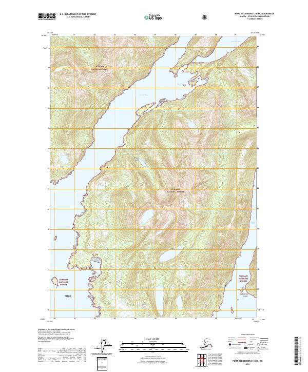
2021 Map of Port Alexander C-4 NE
USGS Topo · Published 2021About this map
Baranof Island serves as the focal point for this survey, dominated by the expansive Tongass National Forest. The coastal geography is defined by a series of deep inlets and protected waterways, including the prominent Necker Bay and the smaller Secluded Bay to the north. These features illustrate the complex maritime landscape of Sitka, where the land is deeply indented by glacial or tectonic activity. Further south, the map identifies Dorothy Cove and the Small Arm inlet, while the Makhnati Islands sit just offshore. This survey captures a region primarily managed for its natural resources, showing the intricate relationship between the mountainous terrain of the national forest and the saltwater channels that provide the only practical access to much of this isolated shoreline.
Find a feature on this map
12 named features on this map. Tap any name to fly to it.
Don’t see what you’re looking for? This feature index may not catch every label — zoom into the map to look around manually.
Map Details
Editions of this 2021 Port Alexander C-4 NE Map
This is the sole edition of this map. No revisions or reprints were ever made.
Other maps of this area

1951 · Port Alexander C-4
USGS Topo · 1:63,360

1951 · Port Alexander D-4
USGS Topo · 1:63,360

1951 · Port Alexander C-3
USGS Topo · 1:63,360

1951 · Port Alexander D-3
USGS Topo · 1:63,360

1951 · Port Alexander
USGS Topo · 1:250,000

1952 · Port Alexander
USGS Topo · 1:250,000

1964 · Port Alexander
USGS Topo · 1:250,000

1994 · Port Alexander C-3
USGS Topo · 1:63,360

1994 · Port Alexander C-4
USGS Topo · 1:63,360
1995 · Port Alexander D-3
USGS Topo · 1:63,360