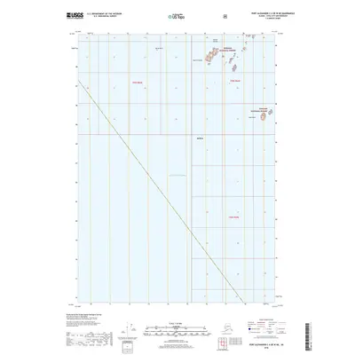
2018 Map of Port Alexander C-4 OE W NE
USGS Topo · Published 2018About this map
Tongass National Forest extends into the northeastern corner of this coastal quadrangle, where a cluster of maritime landmarks dots the waters of the Gulf of Alaska. The map documents a rugged archipelago environment within the Sitka city and borough, characterized by isolated landforms like Rachek Island and the Necker Islands. These outcroppings serve as critical navigational markers along the outer coast of Southeast Alaska. Further south and west, the terrain gives way to open sea, with only the most prominent hazards such as North Rock and Biali Rock breaking the surface. The cartography emphasizes the relationship between the protected federal forest lands and the exposed oceanic boundary, providing a clear record of the shoreline and maritime boundaries near the entrance to the Alexander Archipelago.
Find a feature on this map
10 named features on this map. Tap any name to fly to it.
Don’t see what you’re looking for? This feature index may not catch every label — zoom into the map to look around manually.
Map Details
Editions of this 2018 Port Alexander C-4 OE W NE Map
This is the sole edition of this map. No revisions or reprints were ever made.
Other maps of this area

1951 · Port Alexander D-5
USGS Topo · 1:63,360

1951 · Port Alexander C-4
USGS Topo · 1:63,360

1951 · Port Alexander D-4
USGS Topo · 1:63,360

1951 · Port Alexander
USGS Topo · 1:250,000

1952 · Port Alexander
USGS Topo · 1:250,000

1964 · Port Alexander
USGS Topo · 1:250,000

1994 · Port Alexander C-4
USGS Topo · 1:63,360
2017 · Port Alexander D-4 SW
USGS Topo · 1:25,000
2017 · Port Alexander C-4 NW
USGS Topo · 1:25,000
2017 · Port Alexander D-5 SE
USGS Topo · 1:25,000