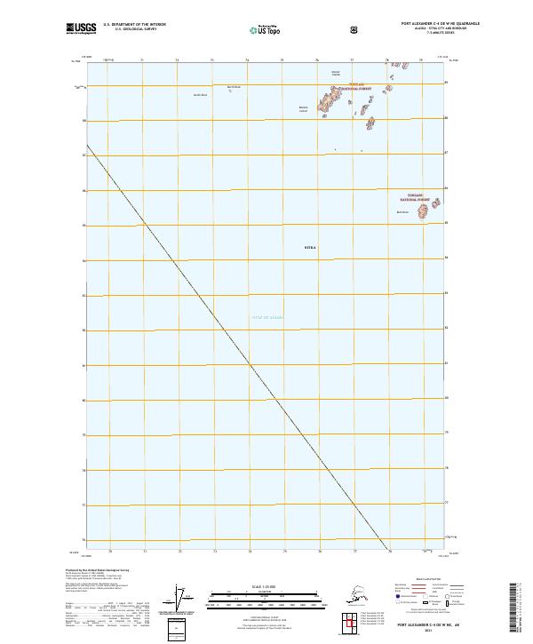
2021 Map of Port Alexander C-4 OE W NE
USGS Topo · Published 2021About this map
Tongass National Forest extends across the northeastern corner of this coastal survey, where a scattered archipelago of small landmasses meets the open ocean. This maritime landscape is defined by the Necker Islands and smaller outcrops like Rachek Island and Biali Rock, which serve as the final landmarks before the seafloor drops into the vast Gulf of Alaska. The map's focus is almost entirely on this transition from protected forest islands to the deep water, providing a precise record of the shoreline and coastal hazards such as North Rock. Within the administrative boundaries of Sitka, the sheet illustrates the relationship between the remote Alaskan wilderness and the sea-lanes that have historically connected this region’s coastal outposts.
Find a feature on this map
10 named features on this map. Tap any name to fly to it.
Don’t see what you’re looking for? This feature index may not catch every label — zoom into the map to look around manually.
Map Details
Editions of this 2021 Port Alexander C-4 OE W NE Map
This is the sole edition of this map. No revisions or reprints were ever made.
Other maps of this area

1951 · Port Alexander D-5
USGS Topo · 1:63,360

1951 · Port Alexander C-4
USGS Topo · 1:63,360

1951 · Port Alexander D-4
USGS Topo · 1:63,360

1951 · Port Alexander
USGS Topo · 1:250,000

1952 · Port Alexander
USGS Topo · 1:250,000

1964 · Port Alexander
USGS Topo · 1:250,000

1994 · Port Alexander C-4
USGS Topo · 1:63,360
2017 · Port Alexander D-4 SW
USGS Topo · 1:25,000
2017 · Port Alexander C-4 NW
USGS Topo · 1:25,000
2017 · Port Alexander D-5 SE
USGS Topo · 1:25,000