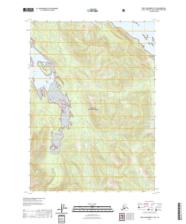
2021 Map of Port Alexander D-1 SW
USGS Topo · Published 2021About this map
Kuiu Island's coastal wilderness within the Tongass National Forest is detailed in this 2021 study, highlighting the complex shoreline of Security Bay and Cedar Bight. The landscape is defined by its significant water features, including Cool Lake and North Cool Lake in the north, and the drainage systems of Dean Creek and Saginaw Cr. Grounded identifiers like Expedition Point and Security Ridge provide critical reference points for navigating the terrain. This map documents the forest service infrastructure through trails and connections such as the Security Bay Connection and Kuiu Connection. The inclusion of specific local identifiers like Bull Buck, Wolf Run, and Tangle Foot provides a localized vocabulary for the ridges and passages of this prince of Wales-Hyder Census Area region.
Find a feature on this map
24 named features on this map. Tap any name to fly to it.
Don’t see what you’re looking for? This feature index may not catch every label — zoom into the map to look around manually.
Map Details
Editions of this 2021 Port Alexander D-1 SW Map
This is the sole edition of this map. No revisions or reprints were ever made.
Other maps of this area

1948 · Port Alexander C-1
USGS Topo · 1:63,360

1948 · Port Alexander D-1
USGS Topo · 1:63,360

1951 · Port Alexander C-2
USGS Topo · 1:63,360

1951 · Port Alexander
USGS Topo · 1:250,000

1951 · Port Alexander D-2
USGS Topo · 1:63,360

1951 · Port Alexander C-1
USGS Topo · 1:63,360

1952 · Port Alexander
USGS Topo · 1:250,000

1964 · Port Alexander
USGS Topo · 1:250,000
1995 · Port Alexander D-2
USGS Topo · 1:63,360
1997 · Port Alexander C-1
USGS Topo · 1:63,360