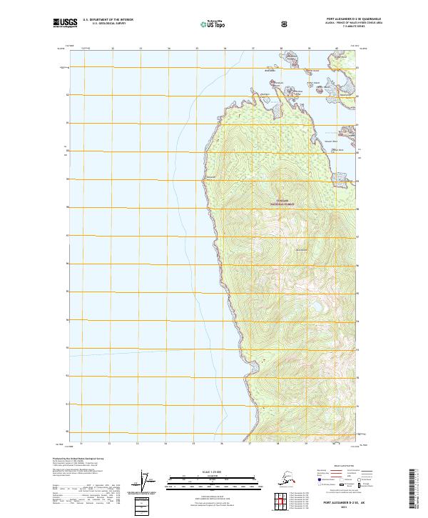
2021 Map of Port Alexander D-2 SE
USGS Topo · Published 2021About this map
Kuiu Island and its intricate northern coastline dominate this Pacific landscape within the Tongass National Forest. The map details a complex maritime environment where the western shore is punctuated by Kingsmill Point and the eastern coast opens into the sheltered waters of Security Bay. This waterway is dotted with small landmasses including Christmas Island, Cedar Island, and Harbor Island, illustrating the navigational challenges and natural harbors utilized by maritime traffic in Southeast Alaska. Dramatic coastal markers such as Retaliation Point, Paralysis Point, and Point Lookout define the topography, while submerged hazards like Bibb Shoal and the protected waters of Band Cove indicate a shoreline shaped by tides and timber.
Find a feature on this map
22 named features on this map. Tap any name to fly to it.
Don’t see what you’re looking for? This feature index may not catch every label — zoom into the map to look around manually.
Map Details
Editions of this 2021 Port Alexander D-2 SE Map
This is the sole edition of this map. No revisions or reprints were ever made.
Other maps of this area

1948 · Port Alexander C-1
USGS Topo · 1:63,360

1948 · Port Alexander D-1
USGS Topo · 1:63,360

1951 · Port Alexander C-2
USGS Topo · 1:63,360

1951 · Port Alexander
USGS Topo · 1:250,000

1951 · Port Alexander D-2
USGS Topo · 1:63,360

1951 · Port Alexander C-1
USGS Topo · 1:63,360

1952 · Port Alexander
USGS Topo · 1:250,000

1964 · Port Alexander
USGS Topo · 1:250,000
1995 · Port Alexander D-2
USGS Topo · 1:63,360
1997 · Port Alexander C-1
USGS Topo · 1:63,360