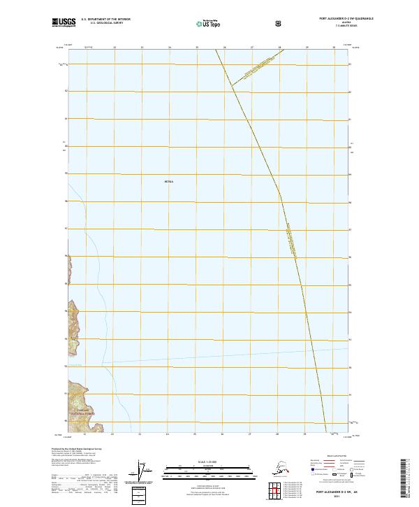
2021 Map of Port Alexander D-2 SW
USGS Topo · Published 2021About this map
Baranof Island serves as the focal point of this coastal survey, where the dense coastal wilderness of the Tongass National Forest meets the Pacific waters of Southeast Alaska. The map highlights the complex administrative geography of the region, showing the convergence of the Sitka city limits with the Hoonah-Angoon Census Area and the Prince of Wales-Hyder Census Area. The shoreline is dominated by the sheltered waters of Hoggatt Bay, which cuts into the western edge of the island. This topographic study emphasizes the intersection of maritime entry points and federal forest management in a region where travel is primarily defined by the coastline rather than roads.
Find a feature on this map
8 named features on this map. Tap any name to fly to it.
Don’t see what you’re looking for? This feature index may not catch every label — zoom into the map to look around manually.
Map Details
Editions of this 2021 Port Alexander D-2 SW Map
This is the sole edition of this map. No revisions or reprints were ever made.
Other maps of this area

1951 · Port Alexander C-2
USGS Topo · 1:63,360

1951 · Port Alexander C-3
USGS Topo · 1:63,360

1951 · Port Alexander D-3
USGS Topo · 1:63,360

1951 · Port Alexander
USGS Topo · 1:250,000

1951 · Port Alexander D-2
USGS Topo · 1:63,360

1952 · Port Alexander
USGS Topo · 1:250,000

1964 · Port Alexander
USGS Topo · 1:250,000

1994 · Port Alexander C-3
USGS Topo · 1:63,360
1995 · Port Alexander D-3
USGS Topo · 1:63,360
1995 · Port Alexander D-2
USGS Topo · 1:63,360