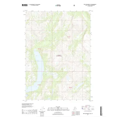
2017 Map of Port Alexander D-3 SW
USGS Topo · Published 2017About this map
Benzeman Lake and Politofski Lake sit within the vast maritime wilderness of Baranof Island during this recent survey. Managed as part of the Tongass National Forest, the terrain is defined by the steep, coastal mountains of the Alexander Archipelago. The southwest corner of the map meets the open waters of the Gulf of Alaska, illustrating the direct relationship between the high alpine interior and the North Pacific shoreline. This 2017 edition provides a precise look at the township and range lines, including t58s r66e and t59s r67e, which overlay a landscape of undisturbed muskeg and steep contour gradients. The lack of roads or established settlements emphasizes the character of this region as one of the most secluded coastal environments in the Sitka City and Borough area.
Find a feature on this map
8 named features on this map. Tap any name to fly to it.
Don’t see what you’re looking for? This feature index may not catch every label — zoom into the map to look around manually.
Map Details
Editions of this 2017 Port Alexander D-3 SW Map
This is the sole edition of this map. No revisions or reprints were ever made.
Other maps of this area

1951 · Port Alexander C-4
USGS Topo · 1:63,360

1951 · Port Alexander D-4
USGS Topo · 1:63,360

1951 · Port Alexander C-3
USGS Topo · 1:63,360

1951 · Port Alexander D-3
USGS Topo · 1:63,360

1951 · Port Alexander
USGS Topo · 1:250,000

1952 · Port Alexander
USGS Topo · 1:250,000

1964 · Port Alexander
USGS Topo · 1:250,000

1994 · Port Alexander C-3
USGS Topo · 1:63,360

1994 · Port Alexander C-4
USGS Topo · 1:63,360
1995 · Port Alexander D-3
USGS Topo · 1:63,360