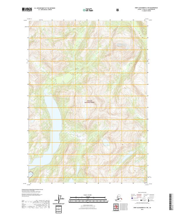
2021 Map of Port Alexander D-3 SW
USGS Topo · Published 2021About this map
Tongass National Forest dominates this coastal Alaskan landscape, where the steep, glacier-carved topography of Sitka City and Borough meets the Pacific. The terrain is defined by extreme elevation changes, rising sharply from the saltwater at Secluded Bay in the southwest corner to high ridges and summits. Tucked between these dramatic peaks is Benzeman Lake, a significant freshwater feature that occupies a narrow valley. The map, produced by the U.S. Geological Survey using data from the U.S. Forest Service, highlights a wilderness area devoid of modern road infrastructure or permanent settlements, reflecting the preserved character of the Alexander Archipelago. It serves as a detailed record of the region's hydrography and untouched timberlands during the early twenty-first century.
Find a feature on this map
7 named features on this map. Tap any name to fly to it.
Don’t see what you’re looking for? This feature index may not catch every label — zoom into the map to look around manually.
Map Details
Editions of this 2021 Port Alexander D-3 SW Map
This is the sole edition of this map. No revisions or reprints were ever made.
Other maps of this area

1951 · Port Alexander C-4
USGS Topo · 1:63,360

1951 · Port Alexander D-4
USGS Topo · 1:63,360

1951 · Port Alexander C-3
USGS Topo · 1:63,360

1951 · Port Alexander D-3
USGS Topo · 1:63,360

1951 · Port Alexander
USGS Topo · 1:250,000

1952 · Port Alexander
USGS Topo · 1:250,000

1964 · Port Alexander
USGS Topo · 1:250,000

1994 · Port Alexander C-3
USGS Topo · 1:63,360

1994 · Port Alexander C-4
USGS Topo · 1:63,360
1995 · Port Alexander D-3
USGS Topo · 1:63,360