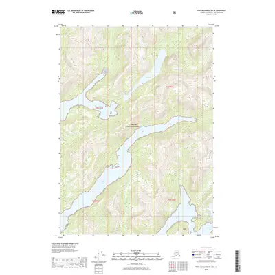
2017 Map of Port Alexander D-4 SE
USGS Topo · Published 2017About this map
Tongass National Forest dominates this coastal landscape in the Baranof Island region, characterized by a complex network of glacial fjords and inland freshwater bodies. The intricate shoreline is defined by deep incisions like Crawfish Inlet and Necker Bay, which reach far into the mountainous interior. Large bodies of water such as Lake Ekaterina and the smaller Benzeman Lake sit elevated above the sea-level inlets, illustrating the dramatic elevation changes typical of this maritime wilderness. The map provides a detailed view of the water-to-land transitions at Shamrock Bay and Secluded Bay, offering researchers a clear picture of the undisturbed natural geography of this remote Sitka City and Borough locale.
Find a feature on this map
11 named features on this map. Tap any name to fly to it.
Don’t see what you’re looking for? This feature index may not catch every label — zoom into the map to look around manually.
Map Details
Editions of this 2017 Port Alexander D-4 SE Map
This is the sole edition of this map. No revisions or reprints were ever made.
Other maps of this area

1951 · Port Alexander C-4
USGS Topo · 1:63,360

1951 · Port Alexander D-4
USGS Topo · 1:63,360

1951 · Port Alexander C-3
USGS Topo · 1:63,360

1951 · Port Alexander D-3
USGS Topo · 1:63,360

1951 · Port Alexander
USGS Topo · 1:250,000

1952 · Port Alexander
USGS Topo · 1:250,000

1964 · Port Alexander
USGS Topo · 1:250,000

1994 · Port Alexander C-3
USGS Topo · 1:63,360

1994 · Port Alexander C-4
USGS Topo · 1:63,360
1995 · Port Alexander D-3
USGS Topo · 1:63,360