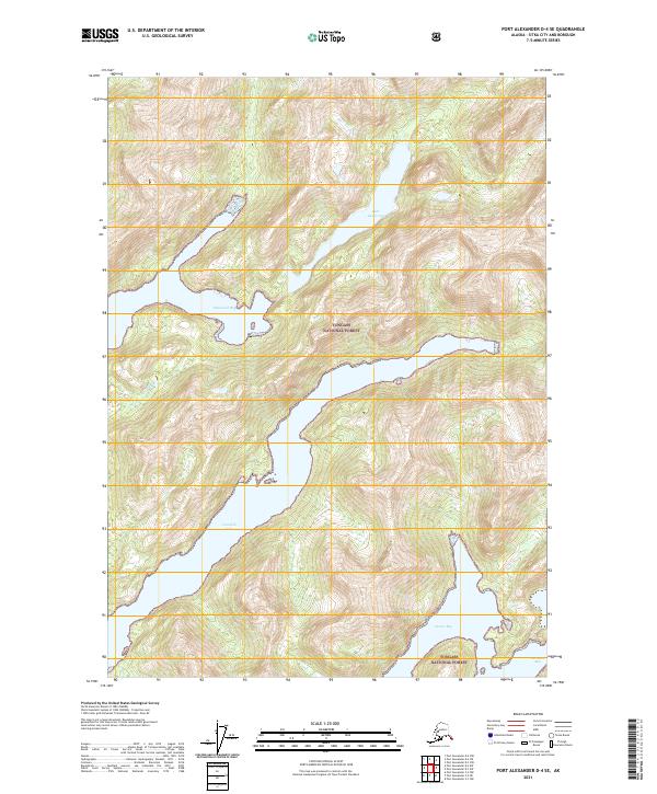
2021 Map of Port Alexander D-4 SE
USGS Topo · Published 2021About this map
Tongass National Forest surrounds this coastal landscape, where the sea deeply penetrates the Baranof Island shoreline through a series of dramatic inlets. The map details the intricate relationship between high alpine terrain and the Pacific tidewaters, most notably at Crawfish Inlet and Shamrock Bay. These narrow waterways provided essential shelter and access for maritime navigation and early resource extraction in the region. To the north, Lake Ekaterina sits elevated among the peaks, feeding into the complex drainage systems that define the Sitka City and Borough geography. The absence of modern road infrastructure highlights the enduring reliance on waterborne travel to reach these secluded stretches of the Alaskan coast, from Necker Bay in the south to the small pocket of Secluded Bay on the eastern edge.
Find a feature on this map
10 named features on this map. Tap any name to fly to it.
Don’t see what you’re looking for? This feature index may not catch every label — zoom into the map to look around manually.
Map Details
Editions of this 2021 Port Alexander D-4 SE Map
This is the sole edition of this map. No revisions or reprints were ever made.
Other maps of this area

1951 · Port Alexander C-4
USGS Topo · 1:63,360

1951 · Port Alexander D-4
USGS Topo · 1:63,360

1951 · Port Alexander C-3
USGS Topo · 1:63,360

1951 · Port Alexander D-3
USGS Topo · 1:63,360

1951 · Port Alexander
USGS Topo · 1:250,000

1952 · Port Alexander
USGS Topo · 1:250,000

1964 · Port Alexander
USGS Topo · 1:250,000

1994 · Port Alexander C-3
USGS Topo · 1:63,360

1994 · Port Alexander C-4
USGS Topo · 1:63,360
1995 · Port Alexander D-3
USGS Topo · 1:63,360