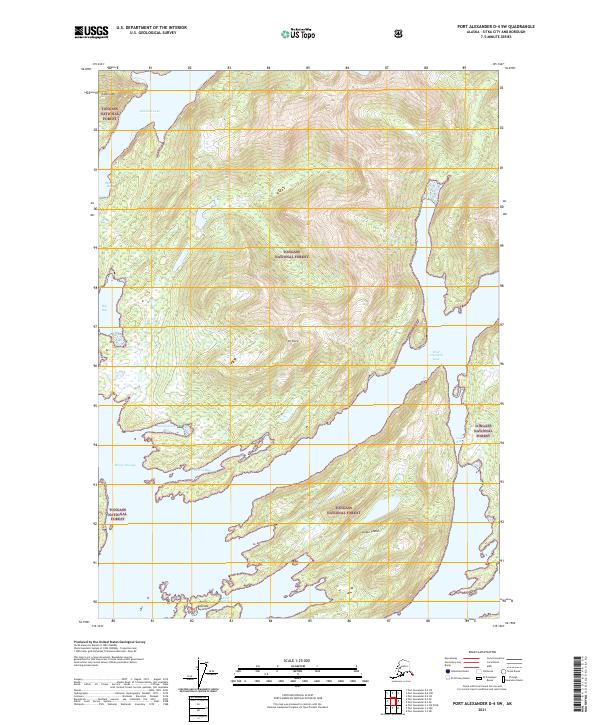
2021 Map of Port Alexander D-4 SW
USGS Topo · Published 2021About this map
The Tongass National Forest dominates this coastal landscape, where high peaks like Mt Sharp and Camel Mtn drop steeply into the Pacific waters of Baranof Island. The intricate coastline is defined by deep fjords and narrow waterways, including the long reach of West Crawfish Inlet and the sheltered Marsh Bay. This map reveals a complex island geography, notably the Rakof Islands at the First Narrows and the isolated Lodge Island situated within the inlet. The inland topography is marked by significant freshwater features such as Redoubt Lake, while the saltwater passages like Windy Passage and Cedar Pass suggest the historic marine routes used for navigation through these southeastern Alaska waters. The absence of roads or established settlements emphasizes the wilderness character of the region, where the terrain is governed by sheer elevation and tidal transitions in bays like Sevenfathom Bay and President Bay.
Find a feature on this map
19 named features on this map. Tap any name to fly to it.
Don’t see what you’re looking for? This feature index may not catch every label — zoom into the map to look around manually.
Map Details
Editions of this 2021 Port Alexander D-4 SW Map
This is the sole edition of this map. No revisions or reprints were ever made.
Other maps of this area

1951 · Port Alexander D-5
USGS Topo · 1:63,360

1951 · Port Alexander C-4
USGS Topo · 1:63,360

1951 · Port Alexander D-4
USGS Topo · 1:63,360

1951 · Port Alexander
USGS Topo · 1:250,000

1952 · Port Alexander
USGS Topo · 1:250,000

1964 · Port Alexander
USGS Topo · 1:250,000

1994 · Port Alexander C-4
USGS Topo · 1:63,360
2017 · Port Alexander D-4 NW
USGS Topo · 1:25,000
2017 · Port Alexander D-4 SW
USGS Topo · 1:25,000
2017 · Port Alexander D-4 NE
USGS Topo · 1:25,000