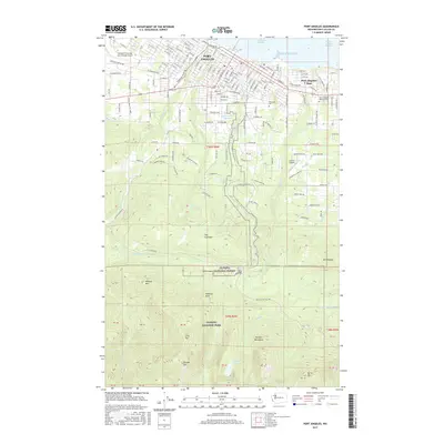
2017 Map of Port Angeles
USGS Topo · Published 2017About this map
Port Angeles and Port Angeles East front the Strait of Juan de Fuca, showcasing a transition from the urban street grids and industrial waterfront of Port Angeles Harbor to the steep wilderness of the Olympic Mountains. The map reveals the city's complex topography, where the developed residential areas and Peninsula Coll give way to The Foothills and the protected lands of the Olympic National Forest. Numerous drainages like Tumwater Cr, Peabody Cr, and Ennis Cr cut through the city, illustrating how the glacial landscape dictated local development patterns.
Find a feature on this map
150 named features on this map. Tap any name to fly to it.
Don’t see what you’re looking for? This feature index may not catch every label — zoom into the map to look around manually.
Map Details
Editions of this 2017 Port Angeles Map
This is the sole edition of this map. No revisions or reprints were ever made.
Other maps of this area

1918 · Port Angeles
USGS Topo · 1:62,500

1919 · Port Crescent
USGS Topo · 1:62,500

1935 · Mount Olympus
USGS Topo · 1:62,500

1938 · Mt Constance
USGS Topo · 1:125,000

1941 · Port Angeles
USGS Topo · 1:62,500

1942 · Mount Olympus
USGS Topo · 1:62,500

1944 · Mt. Angeles
USGS Topo · 1:62,500

1946 · Mt. Angeles
USGS Topo · 1:62,500

1950 · Elwha
USGS Topo · 1:24,000

1950 · Ediz Hook
USGS Topo · 1:24,000