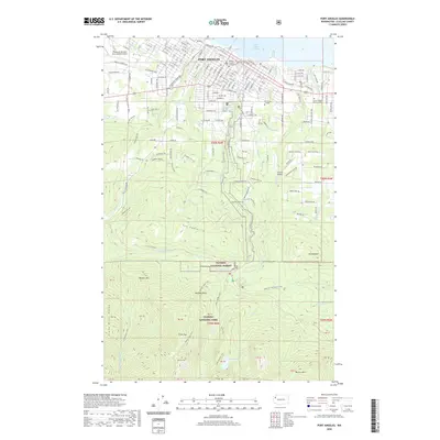
2020 Map of Port Angeles
USGS Topo · Published 2020About this map
Port Angeles serves as the focal point of this coastal landscape, where the urban grid meets the rising slopes of the Olympic Peninsula. The city's civic and educational infrastructure is anchored by the Clallam County Courthouse and Peninsula College, while the William R Fairchild International Airport marks the western edge of development. Beyond the residential streets, the terrain transitions into The Foothills and climbs toward the protected wilderness of Olympic National Park and Olympic National Forest. Numerous drainages like Valley Creek, Tumwater Creek, and Peabody Creek carve through the landscape, feeding into the harbor. Higher elevations reveal distinct landmarks such as Wildcat Mountain and Lake Angeles, illustrating the steep verticality that defines the region's geography. This survey provides a clear view of the modern boundaries between established community spaces like Mount Angeles Memorial Park and the vast timber and parklands to the south.
Find a feature on this map
113 named features on this map. Tap any name to fly to it.
Don’t see what you’re looking for? This feature index may not catch every label — zoom into the map to look around manually.
Map Details
Editions of this 2020 Port Angeles Map
This is the sole edition of this map. No revisions or reprints were ever made.
Other maps of this area

1918 · Port Angeles
USGS Topo · 1:62,500

1919 · Port Crescent
USGS Topo · 1:62,500

1935 · Mount Olympus
USGS Topo · 1:62,500

1938 · Mt Constance
USGS Topo · 1:125,000

1941 · Port Angeles
USGS Topo · 1:62,500

1942 · Mount Olympus
USGS Topo · 1:62,500

1944 · Mt. Angeles
USGS Topo · 1:62,500

1946 · Mt. Angeles
USGS Topo · 1:62,500

1950 · Elwha
USGS Topo · 1:24,000

1950 · Ediz Hook
USGS Topo · 1:24,000