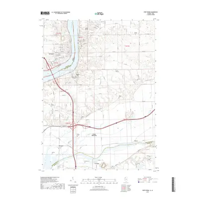
2018 Map of Port Byron
USGS Topo · Published 2018About this map
The Mississippi River serves as the central artery for this borderland where Iowa and Illinois meet. In this 2018 survey, the river is flanked by several established riverfront communities including Port Byron, Le Claire, and Rapids City. The map reveals a high density of small family and community burial grounds, such as the Schaefer Family Cem and the Yost Cem, which highlight the deep roots of the local population. Further south, the landscape transitions toward the industrial and suburban reaches of East Moline and the rural junction of Barstow near the Rock River. Modern infrastructure, including the intersections of Interstate 80, overlays an older grid of township roads and agricultural properties. This recent topography allows for the tracing of long-standing community landmarks, such as the Zion Lutheran Church and various churches and schools that have anchored these river valley settlements for generations.
Find a feature on this map
78 named features on this map. Tap any name to fly to it.
Don’t see what you’re looking for? This feature index may not catch every label — zoom into the map to look around manually.
Map Details
Editions of this 2018 Port Byron Map
This is the sole edition of this map. No revisions or reprints were ever made.
Other maps of this area

1892 · Leclaire
USGS Topo · 1:62,500

1893 · Leclaire
USGS Topo · 1:62,500

1899 · Clinton
USGS Topo · 1:125,000

1934 · Geneseo
USGS Topo · 1:62,500

1937 · Orion
USGS Topo · 1:62,500

1949 · Coal Valley
USGS Topo · 1:24,000

1949 · Silvis
USGS Topo · 1:24,000

1949 · Port Byron
USGS Topo · 1:24,000

1950 · Port Byron
USGS Topo · 1:24,000

1952 · Erie
USGS Topo · 1:62,500