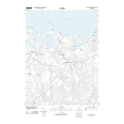
2010 Map of Port Jefferson
USGS Topo · Published 2010About this map
Port Jefferson Harbor and the surrounding North Shore settlements define this coastal study. The maritime character of the region is anchored by the Old Field Point Lighthouse and the transit hub of the Bridgeport Ferry. For genealogists, the map is remarkably dense with historic burial grounds, including the Caroline Episcopal Churchyard and Cemetery, established along with several other denominational and community sites like the Bethel African-American Cemetery and Laurel Hill African-American Cemetery.
Find a feature on this map
80 named features on this map. Tap any name to fly to it.
Don’t see what you’re looking for? This feature index may not catch every label — zoom into the map to look around manually.
Map Details
Editions of this 2010 Port Jefferson Map
This is the sole edition of this map. No revisions or reprints were ever made.
Other maps of this area

1891 · Bridgeport
USGS Topo · 1:62,500

1893 · Bridgeport
USGS Topo · 1:62,500

1902 · Setauket
USGS Topo · 1:62,500

1904 · Setauket
USGS Topo · 1:62,500

1904 · Islip
USGS Topo · 1:125,000

1904 · Moriches
USGS Topo · 1:62,500

1919 · Setauket
USGS Topo · 1:62,500

1920 · Bridgeport
USGS Topo · 1:62,500

1942 · Islip
USGS Topo · 1:125,000
1947 · St James
USGS Topo · 1:24,000