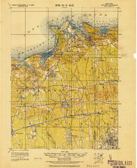
1919 Map of Setauket
USGS Topo · Published 1919About this map
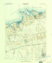
Port Jefferson and the surrounding north shore harbors of Long Island Sound anchor this 1919 tactical survey. The landscape is defined by its maritime and rail infrastructure, from the deep waters of Port Jefferson Harbor to the inland tracks of the Port Jefferson Branch and the Long Island R.R. stretching toward Patchogue. The map captures a moment when the Motor Parkway was a prominent feature of the central island terrain, cutting through the wooded hills near Lake Ronkonkoma. Significant institutional landmarks like the State Hospital for the Insane at Kings Park and the large State Hospital near Central Islip are clearly delineated. Smaller coastal settlements like Setauket, Stony Brook, and Miller Place maintain their early 20th-century footprints before mid-century suburban expansion transformed the Suffolk County interior.
Find a feature on this map
54 named features on this map. Tap any name to fly to it.
Don’t see what you’re looking for? This feature index may not catch every label — zoom into the map to look around manually.
Map Details
Editions of this 1919 Setauket Map
This is the sole edition of this map. No revisions or reprints were ever made.
Other maps of this area

1891 · Bridgeport
USGS Topo · 1:62,500

1892 · Norwalk
USGS Topo · 1:62,500

1893 · Bridgeport
USGS Topo · 1:62,500

1893 · Norwalk
USGS Topo · 1:62,500

1901 · Babylon
USGS Topo · 1:62,500

1901 · Northport
USGS Topo · 1:62,500
1902 · Setauket
USGS Topo · 1:62,500
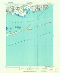
1902 · Fire Island
USGS Topo · 1:62,500
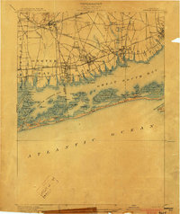
1903 · Babylon
USGS Topo · 1:62,500

1903 · Northport
USGS Topo · 1:62,500