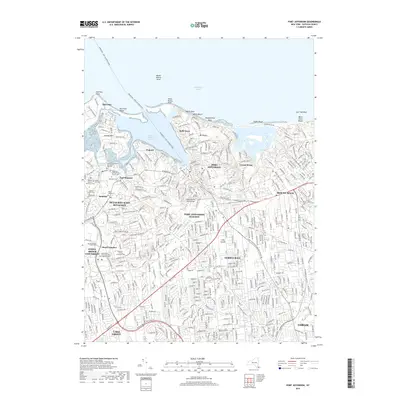
2019 Map of Port Jefferson
USGS Topo · Published 2019About this map
Port Jefferson and its surrounding North Shore hamlets are defined by the intricate relationship between deep harbors and the Long Island railroad corridor. The maritime history of the area is centered on Port Jefferson Harbor, where the Bridgeport - Port Jefferson Ferry connects the village to the mainland across the Long Island Sound. To the west, the village of Setauket maintains deep roots through several colonial-era burial grounds, including the Caroline Episcopal Church and Cem and the Setauket Presbyterian Church Cem.
Find a feature on this map
48 named features on this map. Tap any name to fly to it.
Don’t see what you’re looking for? This feature index may not catch every label — zoom into the map to look around manually.
Map Details
Editions of this 2019 Port Jefferson Map
This is the sole edition of this map. No revisions or reprints were ever made.
Other maps of this area

1891 · Bridgeport
USGS Topo · 1:62,500

1893 · Bridgeport
USGS Topo · 1:62,500

1902 · Setauket
USGS Topo · 1:62,500

1904 · Setauket
USGS Topo · 1:62,500

1904 · Islip
USGS Topo · 1:125,000

1904 · Moriches
USGS Topo · 1:62,500

1919 · Setauket
USGS Topo · 1:62,500

1920 · Bridgeport
USGS Topo · 1:62,500

1942 · Islip
USGS Topo · 1:125,000
1947 · St James
USGS Topo · 1:24,000