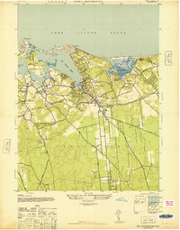
1947 Map of Port Jefferson
USGS Topo · Published 1947About this map
Port Jefferson serves as the deepwater anchor of this coastal survey, where the village streets cluster around the head of Port Jefferson Harbor. The post-war landscape of Brookhaven Town is characterized by its historic harbor settlements and the emerging inland developments like Terryville and Echo. The shoreline is defined by the dramatic relief of Crane Neck and Mt Misery Pt, protecting the quiet waters of Conscience Bay and Setauket Harbor.
Find a feature on this map
30 named features on this map. Tap any name to fly to it.
Don’t see what you’re looking for? This feature index may not catch every label — zoom into the map to look around manually.
Map Details
Editions of this 1947 Port Jefferson Map
This is the sole edition of this map. No revisions or reprints were ever made.
Other maps of this area

1891 · Bridgeport
USGS Topo · 1:62,500

1893 · Bridgeport
USGS Topo · 1:62,500

1902 · Setauket
USGS Topo · 1:62,500

1904 · Setauket
USGS Topo · 1:62,500

1904 · Islip
USGS Topo · 1:125,000

1904 · Moriches
USGS Topo · 1:62,500

1919 · Setauket
USGS Topo · 1:62,500

1920 · Bridgeport
USGS Topo · 1:62,500

1942 · Islip
USGS Topo · 1:125,000
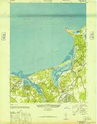
1947 · St James
USGS Topo · 1:24,000