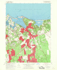
1967 Map of Port Jefferson
USGS Topo · Published 1969About this map
The deep waters of Port Jefferson Harbor and the northern shores of Suffolk County define this mid-century landscape. This survey documents a period of significant growth for Port Jefferson and Setauket, capturing the suburban expansion as residential developments push southward toward Selden and Lake Grove. Significant institutional landmarks are visible, including the sprawling campus of the State University of New York at Stony Brook and the religious enclave at the Monastery of the Little Portion.
Find a feature on this map
110 named features on this map. Tap any name to fly to it.
Don’t see what you’re looking for? This feature index may not catch every label — zoom into the map to look around manually.
Map Details
Editions of this 1967 Port Jefferson Map
This is the sole edition of this map. No revisions or reprints were ever made.
Other maps of this area

1891 · Bridgeport
USGS Topo · 1:62,500

1893 · Bridgeport
USGS Topo · 1:62,500

1902 · Setauket
USGS Topo · 1:62,500

1904 · Setauket
USGS Topo · 1:62,500

1904 · Islip
USGS Topo · 1:125,000

1904 · Moriches
USGS Topo · 1:62,500

1919 · Setauket
USGS Topo · 1:62,500

1920 · Bridgeport
USGS Topo · 1:62,500

1942 · Islip
USGS Topo · 1:125,000
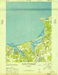
1947 · St James
USGS Topo · 1:24,000