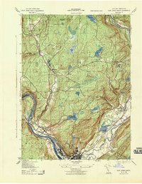
1943 Map of Port Jervis North
USGS Topo · Published 1943About this map
The confluence of the Delaware River and Neversink River anchors this 1943 survey of Orange County, New York, and the northern reaches of Port Jervis. During the early years of the Second World War, the landscape reveals a complex mix of industrial and social infrastructure, from the Deerpark Brewery and Old Bolton Basin near the riverbanks to the Transient Camp located further inland. This area, dominated by the Shangunk Mountains to the east and the high bluffs of Hawks Nest along the river, shows a network of regional transportation including the Erie and New York Ontario and Western rail lines.
Find a feature on this map
53 named features on this map. Tap any name to fly to it.
Don’t see what you’re looking for? This feature index may not catch every label — zoom into the map to look around manually.
Map Details
Editions of this 1943 Port Jervis North Map
This is the sole edition of this map. No revisions or reprints were ever made.
Other maps of this area

1906 · Port Jervis
USGS Topo · 1:62,500

1908 · Port Jervis
USGS Topo · 1:62,500

1909 · Monticello
USGS Topo · 1:62,500

1911 · Monticello
USGS Topo · 1:62,500

1913 · Milford
USGS Topo · 1:62,500

1915 · Milford
USGS Topo · 1:62,500

1922 · White Lake
USGS Topo · 1:62,500

1942 · White Lake
USGS Topo · 1:62,500

1942 · Port Jervis North
USGS Topo · 1:24,000
1942 · Otisville
USGS Topo · 1:24,000