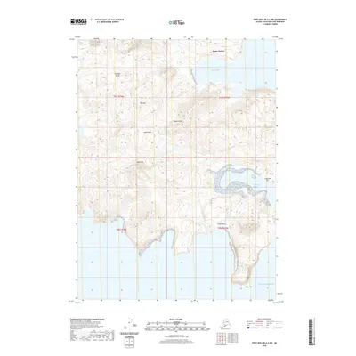
2020 Map of Port Moller A-2 NW
USGS Topo · Published 2020About this map
Unga Island in the Shumagin Islands dominates this 2020 coastal study, showcasing a landscape where maritime access defines the geography. On the island's eastern edge, the settlement of Unga sits near the base of Flagstaff Hill, overlooking the protected waters of Delarof Harbor. This location illustrates the vital connection between land and sea in the Aleutians East Borough, where naturally sheltered harbors provided the only viable sites for established communities.
Find a feature on this map
17 named features on this map. Tap any name to fly to it.
Don’t see what you’re looking for? This feature index may not catch every label — zoom into the map to look around manually.
Map Details
Editions of this 2020 Port Moller A-2 NW Map
This is the sole edition of this map. No revisions or reprints were ever made.
Other maps of this area

1953 · Port Moller
USGS Topo · 1:250,000

1963 · Port Moller A-2
USGS Topo · 1:63,360

1963 · Port Moller B-2
USGS Topo · 1:63,360
1963 · Port Moller A-3
USGS Topo · 1:63,360

1983 · Port Moller B-3
USGS Topo · 1:63,360

1988 · Port Moller
USGS Topo · 1:250,000
2020 · Port Moller A-2 NE
USGS Topo · 1:25,000
2020 · Port Moller B-3 SE
USGS Topo · 1:25,000
2020 · Port Moller A-2 SW
USGS Topo · 1:25,000
2020 · Port Moller B-2 SW
USGS Topo · 1:25,000