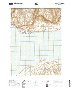
2020 Map of Port Moller B-3 NE
USGS Topo · Published 2020About this map
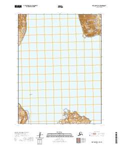
Alaska Peninsula coastline meets the cold waters of Unga Strait in this remote maritime landscape. The topography is dominated by the Aleutian Range, where steep interior slopes descend toward the rocky shorelines of Point Aliaksin and Cape Aliaksin. This survey captures the relationship between the dramatic elevation of the coastal range and the sea, including the formation of Unga Spit to the south. With no roads or established settlements recorded on the sheet, the map serves as a primary record of pure coastal geography and hydrographic features along this stretch of the Aleutians East region. Geologists and maritime historians can trace the precise contours of the headlands and the shifting sands of the spit as they appeared in recent years.
Find a feature on this map
10 named features on this map. Tap any name to fly to it.
Don’t see what you’re looking for? This feature index may not catch every label — zoom into the map to look around manually.
Map Details
Editions of this 2020 Port Moller B-3 NE Map
This is the sole edition of this map. No revisions or reprints were ever made.
Other maps of this area

1953 · Port Moller
USGS Topo · 1:250,000

1963 · Port Moller B-2
USGS Topo · 1:63,360

1963 · Port Moller C-2
USGS Topo · 1:63,360

1983 · Port Moller B-3
USGS Topo · 1:63,360

1983 · Port Moller C-3
USGS Topo · 1:63,360

1988 · Port Moller
USGS Topo · 1:250,000
2020 · Port Moller C-2 SW
USGS Topo · 1:25,000
2020 · Port Moller B-3 SE
USGS Topo · 1:25,000
2020 · Port Moller B-2 SW
USGS Topo · 1:25,000
2020 · Port Moller B-2 NW
USGS Topo · 1:25,000