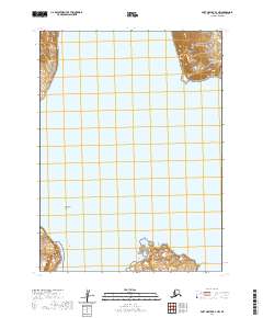
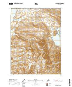
2020 Map of Port Moller B-2 NW
USGS Topo · Published 2020About this map
Balboa Bay dominates the central portion of this maritime survey, illustrating the complex shoreline of the Alaska Peninsula. To the east, the Aleutian Range rises sharply from the water, with Swedania Point marking a prominent turn in the coastal topography. The map reveals a landscape defined by dramatic landforms and coastal hazards, from the southern reach of Cross Cape and West Head to the northwestern prominence of Cape Aliaksin. Offshore, the isolated Gull Island sits within the bay, providing a reference point for the navigational and geological character of this remote coastal region during the early twenty-first century. This sheet is particularly useful for understanding the topographical relationship between the volcanic mountain ranges and the deep-water inlets of the Aleutians East Borough.
Find a feature on this map
12 named features on this map. Tap any name to fly to it.
Don’t see what you’re looking for? This feature index may not catch every label — zoom into the map to look around manually.
Map Details
Editions of this 2020 Port Moller B-2 NW Map
This is the sole edition of this map. No revisions or reprints were ever made.
Other maps of this area

1953 · Port Moller
USGS Topo · 1:250,000

1963 · Port Moller B-2
USGS Topo · 1:63,360

1963 · Port Moller C-2
USGS Topo · 1:63,360

1983 · Port Moller B-3
USGS Topo · 1:63,360

1983 · Port Moller C-3
USGS Topo · 1:63,360

1988 · Port Moller
USGS Topo · 1:250,000
2020 · Port Moller C-2 SE
USGS Topo · 1:25,000
2020 · Port Moller B-2 NE
USGS Topo · 1:25,000
2020 · Port Moller C-2 SW
USGS Topo · 1:25,000
2020 · Port Moller B-3 SE
USGS Topo · 1:25,000