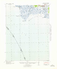
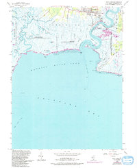
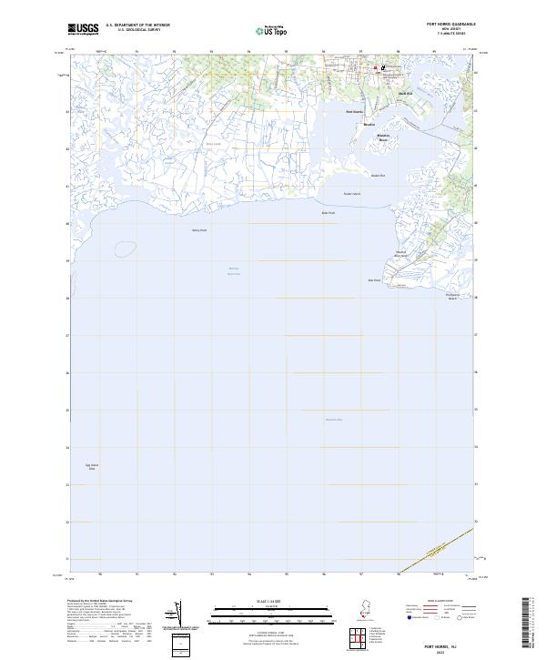
1941 Map of Port Norris
USGS Topo · Published 1941About this map
Port Norris and the neighboring oyster-industry hub of Bivalve dominate the eastern landscape of this early-1940s tactical survey. Situated along the Maurice River, these settlements reflect the maritime economy of the Maurice River Cove before mid-century changes. The Reading Seashore Lines provides the primary rail link to the coast, terminating near the water's edge to serve the local fisheries. To the west, the landscape transitions into an intricate network of wetlands and tidal passages, including Dividing Creek, Oranoaken Creek, and Hansey Creek. Coastal landmarks like Egg Island Point and Beadon Point define the jagged shoreline of Delaware Bay. The map also captures the remote fishing outpost of Fortescue and the landings scattered along the riverbanks, such as Matts Landing, offering a look at the Cumberland County waterfront during a period of significant military and coastal monitoring.
Find a feature on this map
32 named features on this map. Tap any name to fly to it.
Don’t see what you’re looking for? This feature index may not catch every label — zoom into the map to look around manually.
Map Details
Editions of this 1941 Port Norris Map
This is the sole edition of this map. No revisions or reprints were ever made.
Historical Maps of Maurice River Township Through Time
7 maps found
Featured Locations
- Maurice River Township, NJ
- Commercial Township, NJ
- Downe Township, NJ
- Bivalve, Commercial Township
- Port Norris, Commercial Township