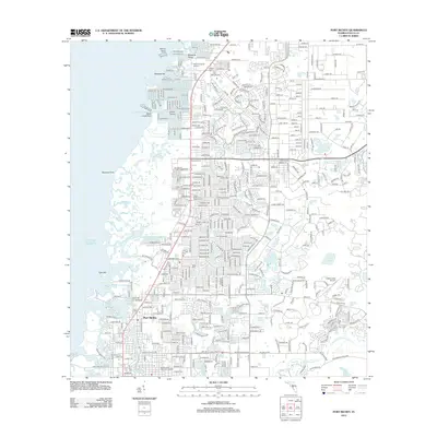
2012 Map of Port Richey
USGS Topo · Published 2012About this map
Port Richey and Bayonet Point anchor this coastal Florida landscape, where the suburban grid meets the intricate marshlands of the Gulf of Mexico. The area is defined by its complex hydrology, featuring numerous named inlets like Hope Bayou, Double Hammock Cr, and the winding Pithlachascotee River to the south. Further inland, the map reveals a high concentration of small lakes and ponds, including Orchid Lake, Garden Lake, and Hidden Lake, which sits adjacent to the Hidden Lake Airport. Several large memorial sites and cemeteries, such as Meadowlawn Memorial Gardens and Grace Memorial Gardens, are prominent landmarks among the residential developments. The coastal fringe remains largely fragmented by water, with features like Skeleton Key, Shine Island, and Yellow Point marking the transition from land to the open gulf.
Find a feature on this map
38 named features on this map. Tap any name to fly to it.
Don’t see what you’re looking for? This feature index may not catch every label — zoom into the map to look around manually.
Map Details
Editions of this 2012 Port Richey Map
This is the sole edition of this map. No revisions or reprints were ever made.
Other maps of this area

1943 · Tarpon Springs
USGS Topo · 1:31,680

1943 · Odessa
USGS Topo · 1:24,000

1943 · Elfers
USGS Topo · 1:24,000

1944 · Elfers
USGS Topo · 1:31,680

1944 · Odessa
USGS Topo · 1:31,680

1948 · Elfers
USGS Topo · 1:25,000

1949 · Odessa
USGS Topo · 1:25,000

1954 · Port Richey
USGS Topo · 1:24,000

1954 · Fivay
USGS Topo · 1:24,000

1954 · Aripeka
USGS Topo · 1:24,000