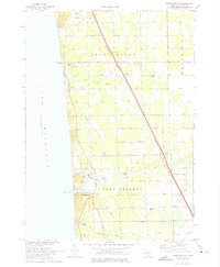
1972 Map of Port Sheldon
USGS Topo · Published 1975About this map
The Lake Michigan shoreline in Ottawa County defines this landscape, where the Pigeon River flows into Pigeon Lake before reaching the big water. By the early 1970s, this area north of Holland shows a mix of recreational and industrial development, including Camp Blodgett and a prominent Powerplant near the lake's edge. The Chesapeake and Ohio railroad cuts diagonally across the townships of Grand Haven, Port Sheldon, and Robinson, connecting the settlements of Agnew and West Olive. Local life is anchored by institutions like Immanuel Ch, Harlem Ch, and the Sheldon Woods Sch. Residential patterns follow a strict grid of roads such as Lake Michigan Drive 45 and Port Sheldon Street, which separate the agricultural fields from the wooded dunes of Pine Ridge.
Find a feature on this map
46 named features on this map. Tap any name to fly to it.
Don’t see what you’re looking for? This feature index may not catch every label — zoom into the map to look around manually.
Map Details
Editions of this 1972 Port Sheldon Map
2 editions found
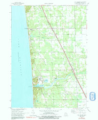
Other maps of this area

1929 · Holland
USGS Topo · 1:62,500

1930 · Lake Harbor
USGS Topo · 1:48,000

1930 · Muskegon
USGS Topo · 1:62,500

1932 · Holland
USGS Topo · 1:62,500

1936 · Muskegon
USGS Topo · 1:62,500

1936 · Lake Harbor
USGS Topo · 1:62,500

1954 · Milwaukee
USGS Topo · 1:250,000

1958 · Milwaukee
USGS Topo · 1:250,000

1958 · Racine
USGS Topo · 1:250,000

1962 · Racine
USGS Topo · 1:250,000
Featured Places
- Port Sheldon, MI
- Olive Township, MI
- Robinson Township, MI
- Port Sheldon Township, MI
- Grand Haven Charter Township, MI