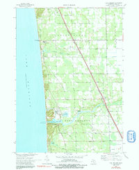
1972 Map of Port Sheldon
USGS Topo · Published 1991About this map
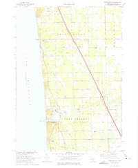
Pigeon Lake serves as a central coastal landmark on this Lake Michigan shoreline, where industrial development and seasonal recreation meet. The map reveals a landscape defined by the drainage systems of Little Pigeon Creek and the Pigeon River, alongside the industrial infrastructure of a large Powerplant and its associated Waste Disp Ponds near the lakefront. The interior is a mix of small settlements and township infrastructure, with the Chesapeake and Ohio railroad corridor cutting diagonally through the townships of Grand Haven, Robinson, and Port Sheldon. Community life in the early 1970s is evidenced by local institutions like Harlem Ch and Sheldon Woods Sch, while the grid of numbered streets and named drives such as Hiawatha Drive show the expanding residential footprint of Ottawa County.
Find a feature on this map
51 named features on this map. Tap any name to fly to it.
Don’t see what you’re looking for? This feature index may not catch every label — zoom into the map to look around manually.
Map Details
Editions of this 1972 Port Sheldon Map
2 editions found
Other maps of this area

1929 · Holland
USGS Topo · 1:62,500

1930 · Lake Harbor
USGS Topo · 1:48,000

1930 · Muskegon
USGS Topo · 1:62,500

1932 · Holland
USGS Topo · 1:62,500

1936 · Muskegon
USGS Topo · 1:62,500

1936 · Lake Harbor
USGS Topo · 1:62,500

1954 · Milwaukee
USGS Topo · 1:250,000

1958 · Milwaukee
USGS Topo · 1:250,000

1958 · Racine
USGS Topo · 1:250,000

1962 · Racine
USGS Topo · 1:250,000
Featured Places
- Port Sheldon, MI
- Olive Township, MI
- Robinson Township, MI
- Port Sheldon Township, MI
- Grand Haven Charter Township, MI