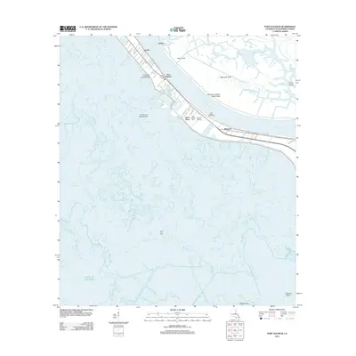
2012 Map of Port Sulphur
USGS Topo · Published 2012About this map
Mississippi River levees define the thin strip of habitable land in this Plaquemines Parish landscape, where the town of Port Sulphur serves as a central hub for the region's industrial and maritime operations. The map documents a complex network of waterways, including the Freeport Sulphur Company Canal and Nestor Canal, which navigate the marshlands leading toward the Gulf of Mexico. Local heritage is preserved at sites like Johnson Fisher Cem and Saint Patrick Cem, while the area's economic reliance on natural resources is evident through the Nairn Oil Field and the Cox Bay Oil and Gas Field.
Find a feature on this map
51 named features on this map. Tap any name to fly to it.
Don’t see what you’re looking for? This feature index may not catch every label — zoom into the map to look around manually.
Map Details
Editions of this 2012 Port Sulphur Map
This is the sole edition of this map. No revisions or reprints were ever made.
Other maps of this area

1891 · Pointe a La Hache
USGS Topo · 1:62,500

1892 · Quarantine
USGS Topo · 1:62,500

1892 · Pointe a La Hache
USGS Topo · 1:62,500

1893 · Fort Livingston
USGS Topo · 1:62,500

1893 · Dime
USGS Topo · 1:62,500

1935 · Port Sulphur
USGS Topo · 1:31,680

1935 · Bastian Bay
USGS Topo · 1:31,680

1935 · Bay Ronquille
USGS Topo · 1:31,680

1935 · Tropical Bend
USGS Topo · 1:31,680

1939 · Pointe a La Hache
USGS Topo · 1:62,500