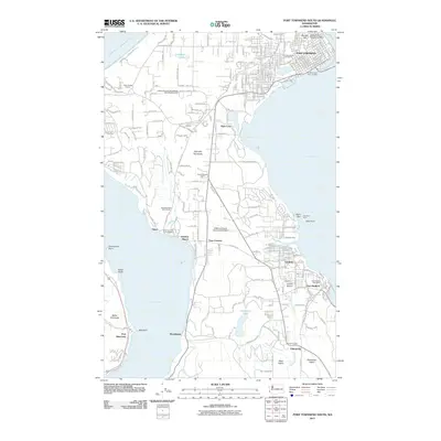
2011 Map of Port Townsend South
USGS Topo · Published 2011About this map
Quimper Peninsula and the surrounding marine landscape of the Olympic Peninsula define this 2011 survey, showing the southern reaches of the historic maritime hub. The map provides clear detail of the established settlements at Irondale, Port Hadlock, and Chimacum, where inland agricultural valleys meet the Puget Sound. Along the eastern shore, Kala Point and Glen Cove mark the entry into the primary harbor, while the western side is dominated by the deep waters of Discovery Bay.
Find a feature on this map
173 named features on this map. Tap any name to fly to it.
Don’t see what you’re looking for? This feature index may not catch every label — zoom into the map to look around manually.
Map Details
Editions of this 2011 Port Townsend South Map
This is the sole edition of this map. No revisions or reprints were ever made.
Other maps of this area

1937 · Port Gamble
USGS Topo · 1:62,500

1939 · Port Townsend
USGS Topo · 1:62,500

1939 · Coupeville
USGS Topo · 1:62,500

1940 · Port Gamble
USGS Topo · 1:62,500

1940 · Quilcene
USGS Topo · 1:62,500

1953 · Coupeville
USGS Topo · 1:24,000

1953 · Nordland
USGS Topo · 1:24,000

1953 · Center
USGS Topo · 1:24,000
1953 · Port Ludlow
USGS Topo · 1:24,000

1953 · Port Townsend North
USGS Topo · 1:24,000