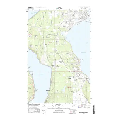
2017 Map of Port Townsend South
USGS Topo · Published 2017About this map
Port Townsend and the surrounding Quimper Peninsula communities are mapped here during the late 2010s, revealing a landscape defined by its maritime heritage and inland transit corridors. The area's settlement pattern is visible from the historic core at Morgan Hill and Point Hudson down to the industrial and residential clusters of Irondale and Port Hadlock-Irondale. The importance of aviation and recreation is evident through the Jefferson County International Airport and the sprawling route of the Pacific NW National Scenic Trail as it winds through the timbered sections of the peninsula.
Find a feature on this map
46 named features on this map. Tap any name to fly to it.
Don’t see what you’re looking for? This feature index may not catch every label — zoom into the map to look around manually.
Map Details
Editions of this 2017 Port Townsend South Map
This is the sole edition of this map. No revisions or reprints were ever made.
Other maps of this area

1937 · Port Gamble
USGS Topo · 1:62,500

1939 · Port Townsend
USGS Topo · 1:62,500

1939 · Coupeville
USGS Topo · 1:62,500

1940 · Port Gamble
USGS Topo · 1:62,500

1940 · Quilcene
USGS Topo · 1:62,500

1953 · Coupeville
USGS Topo · 1:24,000

1953 · Nordland
USGS Topo · 1:24,000

1953 · Center
USGS Topo · 1:24,000
1953 · Port Ludlow
USGS Topo · 1:24,000

1953 · Port Townsend North
USGS Topo · 1:24,000