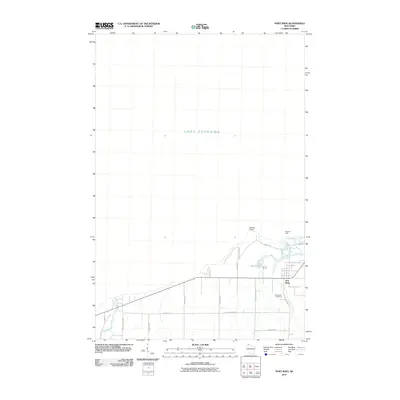
2010 Map of Port Wing
USGS Topo · Published 2010About this map
Port Wing sits at the confluence of the Flag River and the vast waters of Lake Superior, serving as a focal point for this coastal Wisconsin community. The landscape is defined by the transition from the lake's edge at Quarry Point to the inland drainages of Larson Creek and the Iron River. A legacy of navigation is noted at the East Pier Light, guarding the entrance to the small harbor. Nearby, the presence of Bibon Lake suggests the complex shoreline geography typical of this region's south shore. For local historians and genealogists, the Greenwood Cemetery is a significant landmark, situated south of the main settlement. The road network, including County Hwy A and Old Hwy 13, connects the dispersed residential areas and provides access to the coastal features that have long shaped the local economy and lifestyle.
Find a feature on this map
22 named features on this map. Tap any name to fly to it.
Don’t see what you’re looking for? This feature index may not catch every label — zoom into the map to look around manually.
Map Details
Editions of this 2010 Port Wing Map
This is the sole edition of this map. No revisions or reprints were ever made.
Other maps of this area

1943 · Port Wing
USGS Topo · 1:48,000

1943 · Iron Lake
USGS Topo · 1:48,000

1946 · Port Wing
USGS Topo · 1:48,000

1947 · Brule
USGS Topo · 1:48,000

1947 · Iron Lake
USGS Topo · 1:48,000

1953 · Ashland
USGS Topo · 1:250,000

1958 · Ashland
USGS Topo · 1:250,000
1961 · Iron Lake
USGS Topo · 1:62,500
1961 · Port Wing
USGS Topo · 1:62,500
1961 · Brule
USGS Topo · 1:62,500