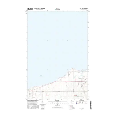
2015 Map of Port Wing
USGS Topo · Published 2015About this map
Lake Superior defines the northern reaches of this coastal landscape along the South Shore of Wisconsin. The small village of Port Wing serves as the focal point of the shoreline, where the land transitions from the expansive waters to the interior of Bayfield County. This 2015 study illustrates the contemporary road network and topographical character of the area, reflecting the modern layout of this harbor community. Researchers can observe the interaction between the lakefront and the established settlement patterns that have shaped the region since its earlier logging and fishing days, as the map details the precise elevations and hydrography of the immediate surroundings.
Find a feature on this map
2 named features on this map. Tap any name to fly to it.
Don’t see what you’re looking for? This feature index may not catch every label — zoom into the map to look around manually.
Map Details
Editions of this 2015 Port Wing Map
This is the sole edition of this map. No revisions or reprints were ever made.
Other maps of this area

1943 · Port Wing
USGS Topo · 1:48,000

1943 · Iron Lake
USGS Topo · 1:48,000

1946 · Port Wing
USGS Topo · 1:48,000

1947 · Brule
USGS Topo · 1:48,000

1947 · Iron Lake
USGS Topo · 1:48,000

1953 · Ashland
USGS Topo · 1:250,000

1958 · Ashland
USGS Topo · 1:250,000
1961 · Iron Lake
USGS Topo · 1:62,500
1961 · Port Wing
USGS Topo · 1:62,500
1961 · Brule
USGS Topo · 1:62,500