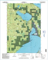
1996 Map of Portage Lake
USGS Topo · Published 1998About this map
Leech Lake Indian Reservation encompasses a significant portion of this mid-1990s landscape, where the waters of Leech Lake and Lake Winnibigoshish dominate the geography. The map reveals a complex network of public lands, including the overlapping boundaries of the Chippewa National Forest and Bowstring State Forest. Significant localized history is found at Ryan Village and the Richards Townsite, reflecting the early 20th-century settlement patterns of Cass County. Transportation and industry are noted by the inclusion of Sucker Bay Road, a prominent Pipeline, and a Gravel Pit. Notable landmarks include Federal Dam and the Rabbits Cemetery, providing essential data for genealogists and local historians tracking the development of the region's shoreline communities and interior forests.
Find a feature on this map
23 named features on this map. Tap any name to fly to it.
Don’t see what you’re looking for? This feature index may not catch every label — zoom into the map to look around manually.
Map Details
Editions of this 1996 Portage Lake Map
This is the sole edition of this map. No revisions or reprints were ever made.
Other maps of this area

1954 · Bemidji
USGS Topo · 1:250,000

1957 · Bemidji
USGS Topo · 1:250,000

1958 · Bemidji
USGS Topo · 1:250,000

1971 · Raven Lake
USGS Topo · 1:24,000

1971 · Bena
USGS Topo · 1:24,000

1971 · Sucker Lakes
USGS Topo · 1:24,000

1971 · Pennington
USGS Topo · 1:24,000
1971 · Bena NW
USGS Topo · 1:24,000
1971 · Federal Dam
USGS Topo · 1:24,000

1971 · Portage Lake
USGS Topo · 1:24,000